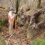
EnviroScience (formerly ClearWater Environmental Consultants) has conducted wetland and stream delineations, including GPS mapping of these features on over 100,000 acres in North Carolina alone. Our delineation and subsequent verification with the U.S. Army Corps of Engineers (USACE) are key parts of successful land development planning.
Wetlands and Stream Delineation
Wetlands and Stream Delineation to establish the existence (location) and physical limits (size) of a wetland for the purposes of federal, state, and local regulations. Wetland delineations are typically required for projects that will impact wetlands or wetland buffers.

